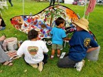
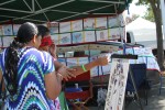
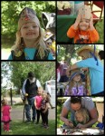
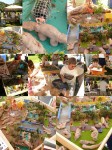
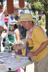
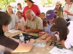
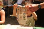
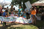
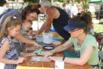
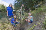
 What did we learn with our event in American Canyon yesterday? We learned that miniature horses are cute. That children (and two adults) love to use the new watercolor markers and make really cute beavers. And that parents cheat and tell their children ‘higher, lower, a little to the left’ when you have them help with pin the beaver on the keystone.
We also learned that American Canyon visitors were a wonderfully diverse mix and parents were very well informed and patient with their children. One father helpfully told us that ‘Keystone’ in Spanish was “Piedra Clave” We learned our new banner was cute and well received, and that at least one federally paid forest service ranger can’t tell a beaver footprint from a badger.
Sheesh!
(They had an interactive game, match the footprint with the animal, where the answer for beaver was obviously wrong. When Cheryl gently explained it to them they said ‘but that’s the way it’s labeled‘ and were reluctant to change it.) Since it’s probably a USFS issued game and everyone uses it, do you think that means the entire forest service can’t tell a beaver footprint from a badger?
Well at least you will be able to.
I will have photos of our day soon, but Cheryl is taking the morning off after working Saturday at the Sonoma event and Sunday at American Canyon. Shhh, Let’s let her sleep in.
Time to make fun of the Colorado project to restore open space by tearing down actual trees and replacing them with concrete trees (no really!) and ripping out an actual beaver dam to replace it with a BDA. Because, progress!
Robert Brakenridge: Boulder County Parks and Open Space has some explaining to do

Most of this property belongs to the public as county open space. However, what is being rebuilt will actually be less”resilient” to coming floods, not more. The process is destroying the existing natural floodplain, in order to restore it.
In May, an experienced birder took groups up the Old St. Vrain road on several weekends and the floodplain wildlife was incredible. The vegetation was already high, tree species were becoming established, there were small local wetland areas: exactly how nature intends floodplains to be, exactly what slows flooding as well. The vegetation and animal diversity were becoming richer with each year. Now much of this has been stripped literally down to bare rock. Old dead cottonwoods that should have been left are gone. Floodplain soils, gone. Raptor habitat, gone. Prime bear foraging areas (and bears), gone. This is public land, expressly put aside to preserve these habitats.
Indeed, the whole concept of “restoring” such an already-beautiful river and floodplain to some idealized “natural” state could have been seen, by the responsible regulatory authorities, by the county, and by SVCC, as plainly inappropriate to start with. Few would argue with local measures to protect dwellings, or to protect public utilities or highways. But employing the same overall river restoration strategy used for urbanized rivers on this relatively natural public land, land that was already restoring itself, is completely inappropriate. Think I am exaggerating? Quoting from the South St. Vrain Design: “Beaver Dam Analogues. Some of the project area prior to the flood was known to hold otter and beaver in small ponds throughout the corridor. A couple of historic beaver ponds were destroyed in the 2013 flood that provided a great wealth of habitat and biodiversity thorough the area. These beaver ponds will be reproduced with the use of Beaver Dam Analogues (BDA) installed as part of this project. BDAs are man-made structures that mimic beaver dams that are found in nature.” This is a very public waste of public funds; the project itself drove away what beavers may have remained.
The project has pulled down giant old dead cottonwoods (important bird habitat): so is now going to erect a few artificial trees. The heavy equipment is stripping and grading the floodplain and channel, and then, because this is an “ecological” design, the same land is going to be roughened up with built riffles and logs dug into the ground to produce local pools and simulate nature. This kind of plan is appropriate when starting with a ruined urban channel. But in this case, the river and floodplain after the flood were more natural than most any other channel and floodplain in the region. For what reasons are they being subjected to this treatment?
Well, I know nothing about this project in particular, but I do know that is a wonderfully well-written letter Professor Robert Brakenridge of Colorado University. And I do know something of the insanity that happens when cities decide to ‘beautify’ and restore rivers by using heavy equipment and ripping the banks and the trees. When man thinks he can outplan nature he is usually wrong.
But by way of comfort I will offer this. Once upon a time, Martinez ripped up it’s creek to protect from flooding and paved the walls with concrete and unnatural surfaces. They shaved the banks and squeezed sheetpile in to keep them from eroding. To make up for the terrible impact they had on the once-natural creek they dedicated one tiny spot to appearing ‘natural’ and planted trees along the newly decimated bank.
6 years later our beaver moved into that VERY spot and built a dam that attracted such wildlife it became one of the most vibrant parts of the city. Be patient.
