Yesterday was a “Bring out your dead” dead kinda day reviewing depredation permits. A hell of a lot of people killing a hell of a lot of beavers. But I found a few tidbits among the wreckage to keep me interested. Our past winners our keeping up with their feverish pace, and there were 24 unlimited permits granted. So that’s still happening. But oddly there were 31 permits denied. Which we’ve never seen before. About half of them note the damage was not verified. But whether that means anything remotely responsible is anybody’s guess. In the meantime we should be thinking about LIVE BEAVERS. And I have just the article to get us hopping. How about a beaver app that you can download to your phone?
iBeaver: Crowd-sourcing data on North America’s Busy Beaver
Help us gather data with a new app!
Beaver are the classic keystone species and ecosystem engineers. Their dams can alter landscapes in positive ways by creating, enhancing and maintaining wetland and riparian habitats for an array of species such as fishes, amphibians, reptiles, mammals, waterfowl, shorebirds, songbirds, plants and invertebrates. These wetlands also provide important ecological services that benefit humans, like groundwater filtration, carbon sequestration and flood attenuation.
Since then, beaver populations have rebounded in many U.S. rivers and streams, but they still haven’t re-inhabited their full historical range or are not present at the density that they were prior to trapping. There are lots of efforts currently working toward increasing our understanding of beaver distribution, but they are mostly specific to a certain region or project. Because of this, we saw an opportunity to develop a broader data collection app that could be used by almost any group or individual interested in beaver across the country. We then aimed to make the data publicly available
Well that certain would be useful. Nice to make it nationally available, although I might use a little caution in states like Idaho and Wyoming where there are plenty of fur trappers looking for a tip.
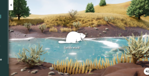
Defenders’ Center for Conservation Innovation (CCI) specializes in finding innovative applications of science, technology and policy for advancing wildlife conservation. So naturally, a collaboration between CCI’s mapping team and our beaver experts in our field conservation department  seemed like a great place to start developing a nationwide beaver data collection tool. Our team decided to use Esri’s Survey123 platform to create iBeaver, a data collection tool that can record the location of a user’s observation and then prompt them to answer a series of survey-style questions to gather more information. This survey is relatively straightforward for the user, regardless of experience or skill level, with explanations and visuals to clarify what a user should be looking for. Over time, the information collected will fill in the knowledge gap of where beaver are, where there is and is not good beaver habitat and where there are beaver-human conflicts on the landscape that might need resolution.
iBeaver joins a myriad of other data collection platforms and software that promote community involvement in scientific data collection, often referred to as “community science”. Community science gathers data for scientists and nonscientists to use, which they otherwise wouldn’t have the time or capacity to gather individually, all while also getting people outside and connected to the natural world. It’s a great way for everyone to contribute to a larger effort, protecting the biodiversity of our planet, while also having some fun and learning along the way.
How cool is that. It almost makes me want a cell phone! HAHAHA. But still, pretty darn nifty to be able to hike along and use your phone to enter beaver data.
The whole thing is so cool and NEW I couldn’t resist entering the laurel creek beavers. A very complete process it is too, with lots of questions about other wildlife you may have observed in the area. The mapper showed another California entry on the border of Nevada What are the odds we know the woman who saw those beavers?
The data collected through this community-driven tool will inform our understanding of the current distribution of beaver. Plus, these data will be shared publicly and can be used to inform policy on wildlife and water use, identify areas where troublesome beaver can be relocated and find areas that don’t currently have beaver but do have wildlife and water that would benefit from their presence. These data would also give us a better sense of beaver populations as they change through space and time and provide lots of other fun, interesting and useful applications which help our natural world. You can check out the data collected with iBeaver in our web map, Castor Mapper.
We need your help to build up our dataset to do all these wonderful things! So take your smartphone and get outside! You can access the survey at this link, and you can fill it out in your web browser or through the Survey123 application that you can download wherever you get your apps. We thank you for your community science contribution and wish you happy trails as you search for beaver in your neck of the woods.
Go enter your local beavers RIGHT now! Let’s show them why the beaver population is worth paying attention too! Great Work Defenders of Wildlife and Center for Conservation Innovation!
